Short Hikes Long Views
by Zak Erb | photography by Clay Dolan & Zak Erb of Escarpment magazine
Looking to take in a long view this fall? Well you’re certainly in the right place. Deciduous trees are in abundance in our next of the woods, which makes for a riot of fall colours. And while an autumn hike through a densely wooded trail in unquestionably delightful, there’s nothing like getting a bit of elevation and exposure to really capture fall in all its glory. This is where the Escarpment coms in – we breakdown 11 amazing (and brief) hikes that boast the best vantage points for incredible fall foliage views.
ONE: Skinner’s Bluff Trail
Location: 483165-483121 Colpoys Range Rdm Wiarton | Length: 1.5-3 km | Difficulty: Easy, but mind the gap
This is one of the area’s most popular lookouts for three good reasons; the view is unbelievable. From the roadside parking area, follow the main Bruce Trail north. The bluff, jutting straight out about marsh and woodland below, reveals itself after just a few hundred metres. Be sure of your footing as you cross the gap into the bluff, then collect your best selfie of the season. Extend your hike by continuing along the trail before taking the Chris Walker Side Trail south back to parking.
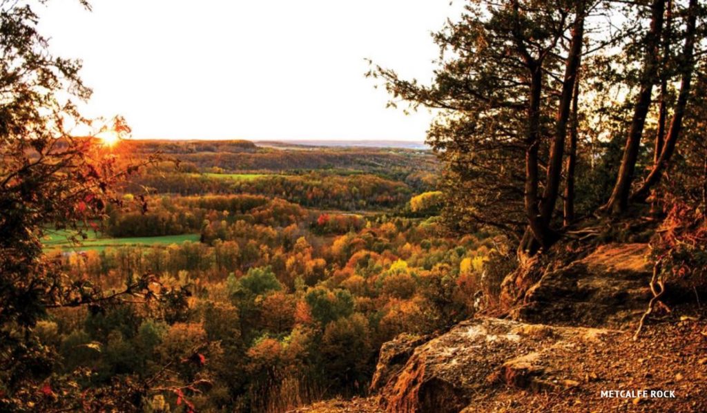
TWO: Metcalfe Rock Side Trail Loop
Location: 415400 10th Line, Ravenna | Length: 1.5-3 km | Difficulty: Moderate
Metcalfe Rock has it all; a nice hike through mixed terrain with elevation gain; incredible rock features including crevices and caves; and a massive west facing view from atop the Escarpment. From the parking on the 10th Line follow the access trail to connect with the main Bruce Trail A switchback brings you up the Escarpment and the lookout is just ahead. As always, mind your footing near the edge. Take in the view then explore the crevice below, or continue on for a short loop (bear to the right at trail branches) back to parking.
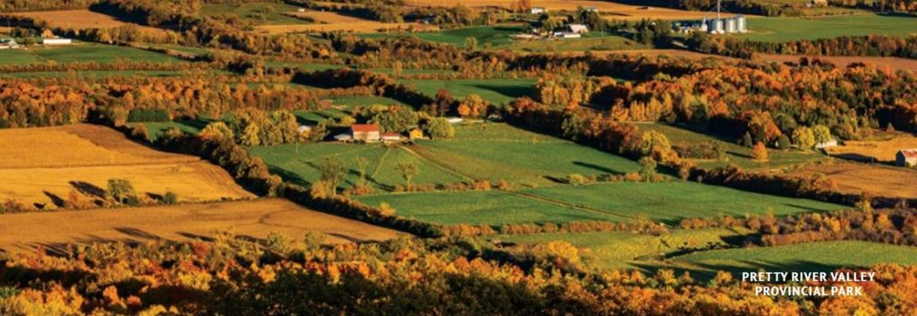
THREE: Pretty River Valley Provincial Park
Location: south east of Collingwood, access points on Pretty River Road & Sideroad 6 | Length: 5 km + | Difficulty: Easy to moderate
Boasting the highest point on the Bruce Trail, Pretty River Valley Provincial Park is well worth your hiking time. To visit the highest point, make use of the parking area on 2nd Line, just north of the park off Sideroad 6. Then follow the John Haigh Side Trail south for just over 2 km. There is no lookout from the highest point, but it serves as a hub which opens up the rest of the park. Complete the side trail and head south if you’d like a long hike, or follow the main Bruce Trail east 1.7 km where you’ll find a lookout area, before looping back via the Russ McConnell Side Trail – about 8.5 km total.
FOUR: Nottawasaga Lookout Provincial Nature Reserve
Location: Corner of Osprey Clearview Townline & Eagle Crescent (off of Grey Rd 31) | Length: 300 m-2 km + | Difficulty: Easy to moderate
Perched along the southern wall of the Pretty River Valley, the Nottawasaga Lookout Provincial Nature Reserve offers fleeting glimpses of the valley below. Further to the northeast Collingwood & Georgian Bay come into view. A quick 300 m hike along the main tract of the Bruce Trail brings you to steep limestone face at the edge of the Escarpment. For the more adventurous a few short – unmarked offshoot trails offer the best views, but the terrain is treacherous with deep crevasses and towering cliffs.
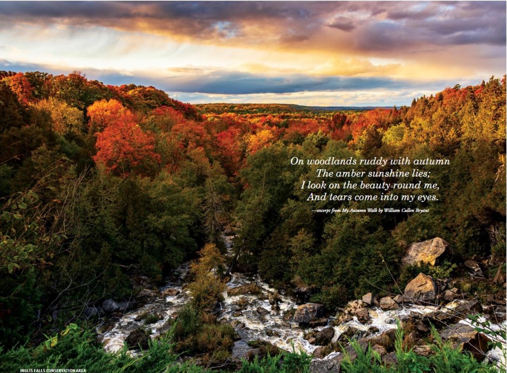
FIVE: Inglis Falls Conservation Area
Location: 237785 Inglis Falls Rd, Owen Sound | Length: 0-50 m | Difficulty: NIL
If maximum payoff with minimal effort is the name of your game, or if you’re not up for much of a hike, then Inglis Falls is the right choice. Pay for parking, exit your vehicle and you’re there, the view is impossible to miss. The Sydenham River opens up the woods before you as trees ablaze with orange and red roll in to the horizon. It is unreal. Of course, there is the view of the falls to enjoy as well, with elevated viewing areas on either side of the falls, just steps from parking.
SIX: Jones Falls & Pottawatomi Conservation Area
Location: 717875 Hwy 6, Owen Sound | Length: 3-5 km | Difficulty: Easy to moderate
The falls are not the only payoff in this 116 hectare gem. Those who hike past the falls are presented with a series of lookout points atop the Escarpment with east facing towards Owen Sound. From the parking area, follow the river to the falls, then continue on the main Bruce Trail along the top of the Escarpment. Keep trekking until you’ve had your fill of stunning views then turn back, or descent to the Memorial Forest Side Trail to loop back to the falls.
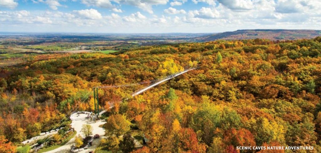
SEVEN: Scenic Caves Nature Adventures
Location: 260 Scenic Caves Rd, Blue Mountains | Length: 1-15 km | Difficulty: Easy to advanced
Scenic caves is absolutely worth the price of admission ($28.75 for an adult). Besides boasting a fascinating network of caves and crevices, Scenic offers 15 km of trails through a hardwood forest on the Escarpment. Find an amazing lookout on the approachable Caves/Lookout Trail, or to really blow your mind, head south from the gate on the Suspension Bridge Loop. This quick 1 km loop takes you over Southern Ontario’s longest suspension bridge with views of the forest floor more than 80 feet below.
EIGHT: Blue Mountain Resort
Location: 190 Gord Canning Dr, The Blue Mountains | Length: 100-300 km + | Difficulty: Easy to moderate
Enjoy scenic views of the Escarpment from Blue Mountain Village, or head up the Open-Air Gondola for panoramic vistas overlooking Collingwood & Georgian Bay. A wide range of terrain, difficulty levels, and vertical gains suit beginner to advanced hikers of all ages. Your “Explore All Day Pass” gives you unlimited access to the Open-Air Gondola & 30 km of hiking trails. Ski-season pass holders also have unlimited access to the 24 hiking trails.
NINE: Millennium Overlook Park
Location: 45 Heritage Drive, Collingwood | Length: <1 km | Difficulty: NIL
This little park, tucked in behind the famed grain terminals at the Collingwood Harbour, is a hidden gem. Visitors are presented with a massive panorama including Georgian Bay, the Town of Collingwood, and the rolling mass of the Niagara Escarpment towering over it all to the west. Find Millennium Overlook by parking at the nearby Harbourlands Park on Heritage Drive and walking past the Collingwood Terminals, you can’t miss it.

TEN: Meaford Bruce Trail
Location: Euphrasia-St.Vincent Townline between Grey Rd 7 & 7th line | Length: 2.5 km (5km round trip) | Difficulty: Easy
This meandering stretch of Bruce Trail highlights the timeless beauty of rural Ontario. From the parking area on Euphrasia – St.Vincent Townline, follow the Bruce Trail as it climbs up though the colourful deciduous canopy. The trail darts in and out of the forest until you are treated to classic autumn views across rolling farm fields overlooking Meaford and Georgian Bay.

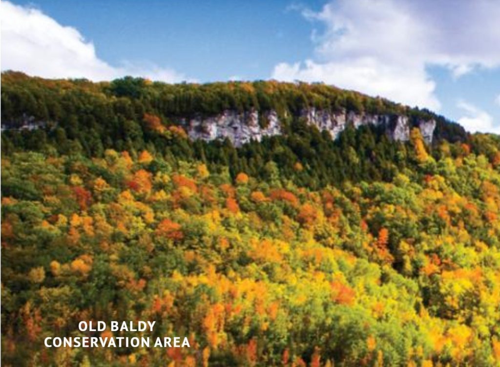
ELEVEN: Old Baldy Conservation Area
Location: 117 Old Baldy Access Rd, Kimberley | Length: 2+ km | Difficulty: Moderate
Old Baldy is the jewel in the autumn crown of the Beaver Valley, which is saying something as the entire valley positively lights up this time of year. From the busy parking area off Sideroad 7B follow the trail south until you reach the Mac Kirk Side Trail. If parking is full when you arrive, do not park on the roadside, instead, try the parking area on Grey Rd 13 – it’s a longer hike, and you climb the whole way. The work you put in on the ascent pays off dramatically once you find yourself 150 m above the valley floor looking out over the beautiful town of Kimberley and beyond.
To read more great articles, head to: https://www.escarpmentmagazine.ca/
Share
More Posts
Tips, advice, news and more. Scroll through our blogs for interesting reads.
